The sqwʔa (Peachland Creek) Watershed
sqʷʔa (Peachland Creek) is located within the traditional, ancestral, unceded territory of the syilx people, just south of the Town of Peachland, within the semi-arid Okanagan Valley of British Columbia. sqʷʔa (Peachland Creek) is part of the Okanagan River Basin, which is part of the Columbia River Basin, which flows into the Pacific Ocean.
The syilx people utilize the sqʷʔa watershed for fishing (particularly Hardy Falls), hunting and gathering plants for food, ceremony, medicine and technology. Families gather in the fall to fish for kəkniʔ (kokanee).
“Peachland watershed was —and still is—a really important site for our people throughout the Okanagan Syilx communities. For thousands of generations, we looked after this place, and nobody from any of the governments ever consulted with our communities.”
—Dr. Jeannette Armstrong, Syilx Knowledge
Examining impact
A number of human activities within the sqʷʔa (Peachland Creek) watershed have the potential to change the quantity, quality, timing and magnitude of streamflow, habitat value, drinking siwłkʷ (water) security, and a number of other important values that are critical to sustain life in the watershed.
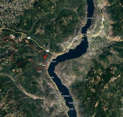
sqʷʔa (Peachland Creek) in photos
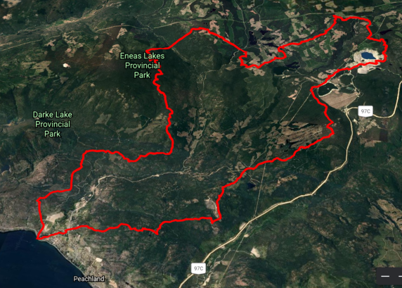 sqʷʔa (Peachland Creek) flowing into Okanagan Lake (bottom left corner)
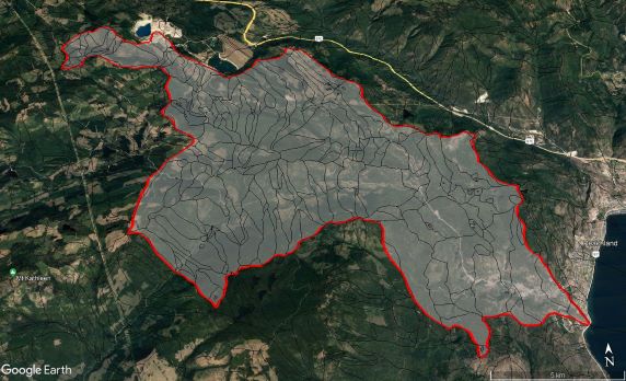
Sub-basins of sqʷʔa (Peachland Creek) shown as thin black lines within the watershed
-
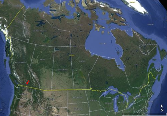
Location of sqʷʔa (Peachland Creek) in Canada
-
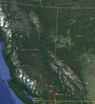
Location of sqʷʔa (Peachland Creek) in syilx territory, British Columbia
-
Location of sqʷʔa (Peachland Creek) in the Central Okanagan, between Kelowna and Summerland